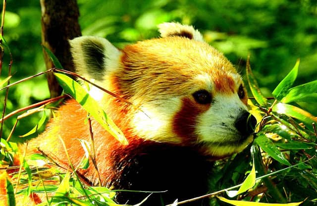
Talking about one of the best treks in the Eastern Himalaya Region, Singalila Sandakphu trek through Singalila National Park( Darjeeling, West Bengal) is truly a fascinating trek that brings you close to Mother Nature. Singalila National park is a part of Red Panda Conservation and Breeding program, hence red pandas can be easily sighted along with some of the rare birds and butterflies during the trek.
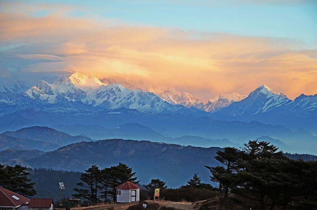
The Singalila trek is classified as Easy to Moderate in nature and is a very popular trek route among all age groups. The maximum altitude of the trek is 11929 ft at Sandakphu, though there is a quite decent distance to be covered downhill during the trek. The trek also offers breath-taking views of the Himalayan range from Cho Yo to Kanchenjunga.
As the major part of the trek proceeds through the Singalila National park, the entire journey offers you various shades of the natures beauty. With the mountains decorated with green alpine trees, magnificent monasteries soaked up in rich cultural history, hues of flowers, verdant paddy valley, and emerald forest. Singalila Sandakphu trek is ideal for nature lovers and wildlife enthusiasts.
The best season for the trek is between May to June or from Mid- September till October end. The weather conditions are quite pleasant and the forest is covered with a wide range of flowering plants during this season.
Itinerary Of Singalila Trek is as follows:
Day 1 – From Bagdogra – Darjeeling Or From New Jalpaiguri to Darjeeling
On day 1, after arriving at Bagdogra Airport hire a cab or take a bus towards Darjeeling town. This distance of 96 kilometers from Bagdogra to Darjeeling will take 3-4 hours to complete. This entire journey by road is a drive through the zigzag Darjeeling valley amidst the tea estates.

If you are coming by train, you can either take a bus or cab from NJP railway station to reach Darjeeling town. Or you can also take the Darjeeling Himalayan Railways and reach Ghoom railway station, which is near to Tonglu.
Tonglu can be regarded as the start point of Singalila trek. At Tonglu you can stay at the government tea house for the night and start your journey the next morning. You can also opt for Darjeeling Tourist Lodge which is provided by WBTDC(West Bengal Tourism Department), if you are looking for budget stay in Darjeeling.
| Name: |
Darjeeling Tourist Lodge
|
| Address: |
Bhanu Sarani Post, Chauk Bazaar, Darjeeling, West Bengal 734101
|
| Contact Number: | 9733008684 |
| Location | |
| Booking |
Day 2 – From Darjeeling – Dhotrey (by bus or cab) & Trek from Dhotrey to Tonglu
On day 2, hire a cab or a shared jeep that will drop you to Dhotrey. Dhotrey which is a tiny settlement of around 80- 85 homes is about 43 kilometers away from Darjeeling. It will require 2-2.5 hours to reach Dhotrey via Maneybhanjang.
Maneybhanjang is the nearest town to the Singalila National Park and you can get your hand on anything essential for your trek ahead from Maneybhanjang itself.

Now, from Dhotrey which is located at 8500 ft, the trek begins towards Tonglu, which is at a height of 10,130 ft. This beautiful trek is covered through the Rhododendron Woodlands and Dense forest. It is 6 kilometers journey from Dhotrey to Tonglu and takes 2.5 – 3 hours to complete.
The route towards Tonglu is through the steady pace amidst pine, oak-acorn and rhododendron woodlands. Also, during the journey, you will come across the sideboard of Tonglu Medicinal Plant Conservation Area.This is the point where the medicine plant forest of Sanagalila Range starts.
The motorable road that comes from Maneybhanjang joins the trek route close to the arch. The magnificent view of Kanchenjunga snow peaks is quite visible from Tonglu. On a bright sunny even the Mt. Everest can be seen from Tonglu. There is a GTA(Gorkhaland Territorial Administration) operated trekkers hut in Tonglu, where you can halt for the night stay.
| Name: |
GTA Trekkers Hut (Tonglu Trekkers Hut)
|
| Address: |
Singalila Forest, West Bengal, Pin: 734221
|
| Contact Number: | 090880 30683 |
| Location: |
Day 3 – Trek from Tonglu to Kalapokhari
On the 3rd day, start your trek towards Tumbling, which is 2 kilometers away down the hill. Tumbling is a small settlement at an altitude of 9600 ft. It takes maximum 1 hours to reach Tumbling. Take a little break at Tumbling and again gear up for the trek further. Many of the trekkers prefer to stay at Tumbling rather than Tounglu as Tumbling has many private lodges and tea houses.
After reaching Tambling, on covering a distance of 1 kilometer(30-40 mins trek), you will reach the gateway to Singalila National Park, which is the highest altitude national park in the state of West Bengal and one of the popular National Park in Eastern India.
For entering and trekking through the Sangalila National Park, one must have the permit. If you haven’t taken the permit yet, then you can collect the permit from the check post at the Singalila gate to travel further through the National Park. On walking a few steps inside the Sangalila National Park, the road splits into three routes towards Joebari and thereafter towards Gairbas.

Joebari is a 6-kilometer trail from Tambling at an elevation of 9186 ft and the trek duration is 3-3.5 hours. This route till Jhaubari is almost steady with a little downhill route. Joebari is again a small village inside the National Park near to the Nepal Territory. This route towards Garibas through Joebari goes through Nepal, and you can see the prominent mixed culture among the locals. You can stop here for a while to catch up some tea and snacks, which are basically home-made by the villagers.
From Joebari one has to take a right turn towards Gairibas. It is further 1km ahead and located at an altitude of 8,600 ft. In maximum 30- 40 minutes, you will reach Garibas which is where you halt for quite some time here. From Tambling, up to Jabari, the route is a gradually descending and a relatively easy trek. But after Joebari it is a steep descend up to Gairibas.
The trek route passes through bamboo glades. Gairibas is essentially a valley full of bamboo groves. If you are here during late spring, you can see colorful red Rhododendrons in full blossom. From Gairibas, the route is a steep climb for about 2kms till you reach a tiny settlement known as Kaiyakatta. There are only a couple of stalls here where you can get refreshment and water.
From Gairibas, the trek up to Kalipokhri takes about three hours to cover the distance of 6 kilometers. It’s at an altitude of 10,400 ft. Initially, you will trek uphill through forests of oak, rhododendrons, and bamboo to reach Kaiyakatta in about 1.5 hours which is about 2kms from Gairibas. The trail is up & down from here. In another 1.5 hours or so you will reach Kalipokhri.
You will pass through a forest of rhododendron, Singalila Sanctuary and then by the pond to reach the Kalipokhri village area. This is where most of the trekkers stay at night. There are several private lodges here. Even the distance covered on this day is long but is not so tiresome as most of the distance is covered downhill.

Day 4- Trek from Kalipokhari to Sandakphu
The final destination Sandakphu is quite visible from the Kalipokhrari. Kalipokhari also provides you a nice view of sunrise behind the Kanchenjunga peaks from your huts.
From Kalipokhri, the trekking route gradually ascends up to Bikheybhanjang which is located 2 kilometers away. On the way, you will cross a place called Chowri Chowk (there is no signboard though) where you can take a break for a couple of minutes. On reaching towards Bikheybhajang you will notice a small hamlet. This place or the entire Sangalila National park is often addressed as “Valley of Poison” because of the poisonous Aconite plants that grow in abundance around this place
On proceeding further, you will come across another small Check Post, from where again 3 routes divide towards gravel road. A trail on the left passes through lovely meadows is the best route as this route is full of wildflowers (this is also a motorable route, but very steep and narrow). Another is a steep stairway right ahead climbs up to a Stupa on top and then continues and meets the gravel road.
From Bikhheybhanjang the climb up to Sandakphu is the steepest. The 4kms route can easily take about 2.5 hours. As Sandakphu is located at a height of 11929 ft hence, there are times along your trek where the steep are about 60 to 75 degree sharp.

Sandakphu is the place from where you get a 180-degree panoramic vista of some of the highest and most beautiful peaks of the world, right from Nepal all the way up to Arunachal. Some of the greatest peaks include the Mt Everest, Makalu, Kanchenjunga, Lhotse, Chomolhari, Pandim, Three Sisters, Kumbhakarna etc.
The Kanchenjunga and its ringing ranges appear like somebody sleeping up-close and thus the sight is known as ‘The Sleeping Buddha’. This trek also provides the panoramic view of the neighboring mountains – Frey Peak (5830m), Koktang (6,148m), Kabru Peak (7,412 m), Ratong, Chandra Peak and the Kabru Dome (6600m). With a fine mix of adventure, culture, and sightseeing, the experience of this trek is beyond comparison.
There is a GTA lodge in Sandakphu and also several other private accommodations.
| Name: |
Sandakphu Trekkers’ Hut(GTA lodge)
|
| Address: |
Singalila Forest, West Bengal 734201
|
| Contact Number: | |
| Location |
Day 5 – Trek from Sanadkphu to Gurdum: From Gurdum to Sepi and From Sepi to Darjeeling( via Bus or cab):
On the 5th day, start your trek towards Gurdum which is a descending trail. During your trail, the forest comprises of the bamboos, oak, acorn, pine, and rhododendrons. you will also witness the most stunning views of Himalaya, of all the mighty mountains in one massive arc that covers the 3 countries of Bhutan, Nepal, and India.

While descending, you will be able to see the way to Sirikhola. Out far are the hamlets of Sikkim. On your arrival at Gurdum, a chorten with a white flag greets the trekkers for their incredible journey. Take a little break here at any the tea houses and prepare yourself towards the final destination.
Now, climb down from the teahouse to Siri River. Cross the bridge and start the trail further. Trek away above the Timburay hamlet and climb down on a steady pace to the lodges plonked at Sirikhola at the meeting of Siri River where a tiny tributary comes from the left.
Take a halt for tea and later take the descent to the massive suspension bridge over the river. Proceed trekking by the water body and pass small lodges, shops, and finally to reach Sepi. From Sepi you can easily catch a bus or hire a cab towards Darjeeling town. On reaching Darjeeling spend the night in the Darjeeling Tourist Lodge under the WBTDC or you can opt for any private hotel.
Day 6- From Darjeeling to Bagdogra Or New Jalpaiguri
As the trip ends here, hire a cab or bus towards your respective destination. This marks the end of the Singalila Sandakphu ridge trek.